Townsites
Townsites
Home NEW Updates About Us Feedback Historic Sites Consultants Contact Us Terms/Conditions
|
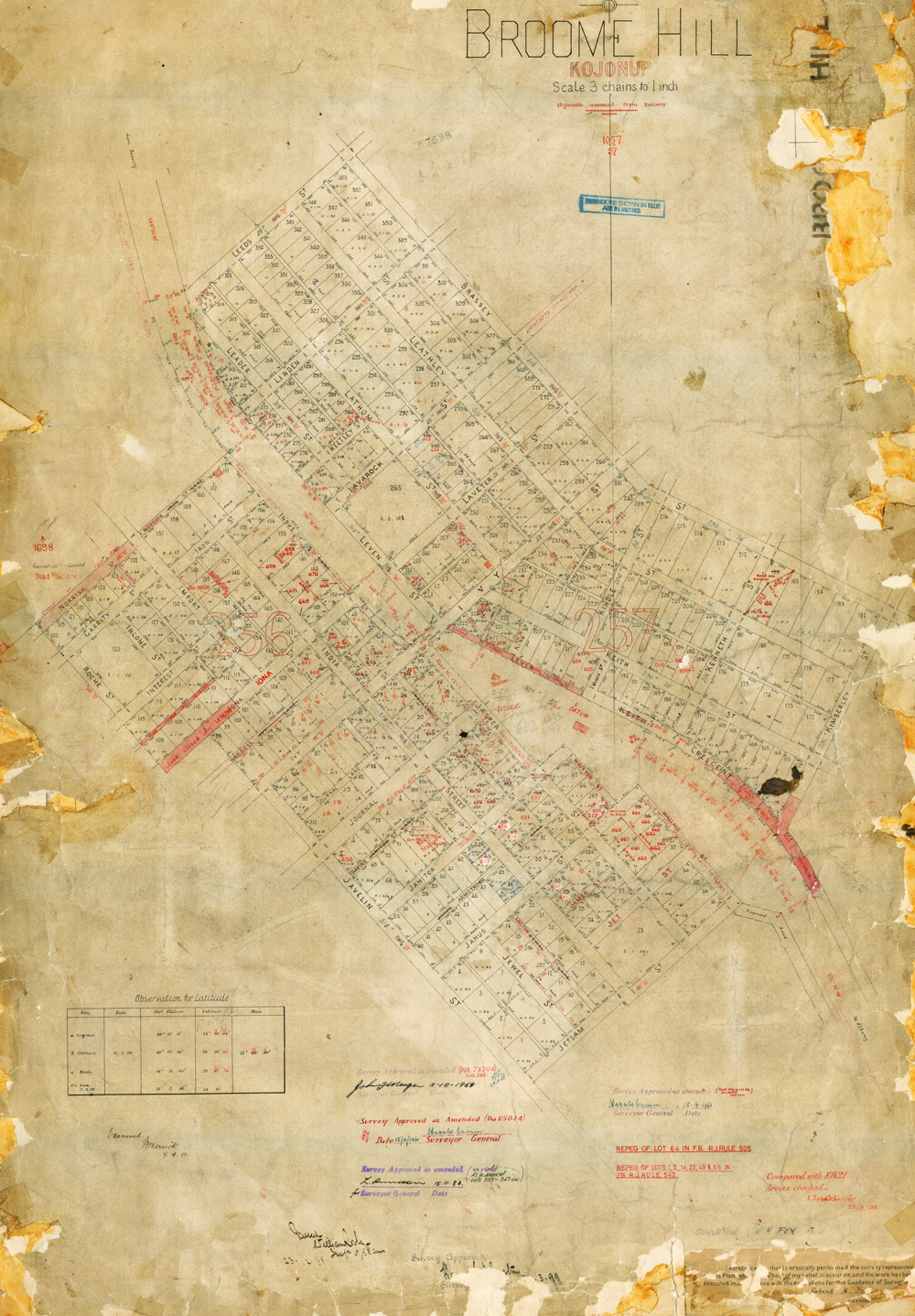
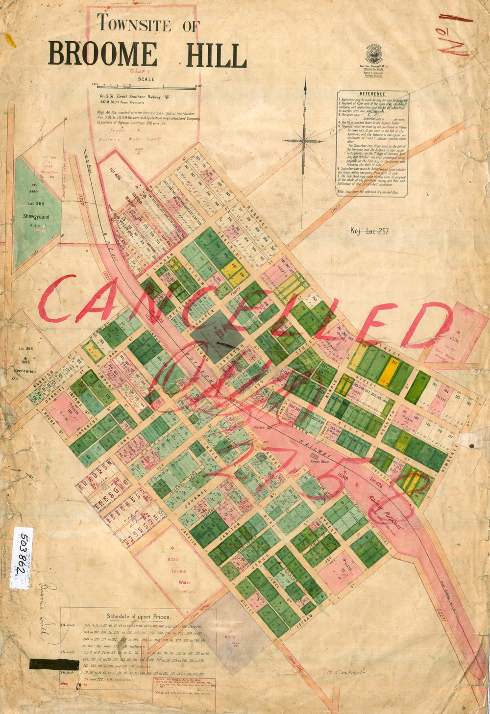
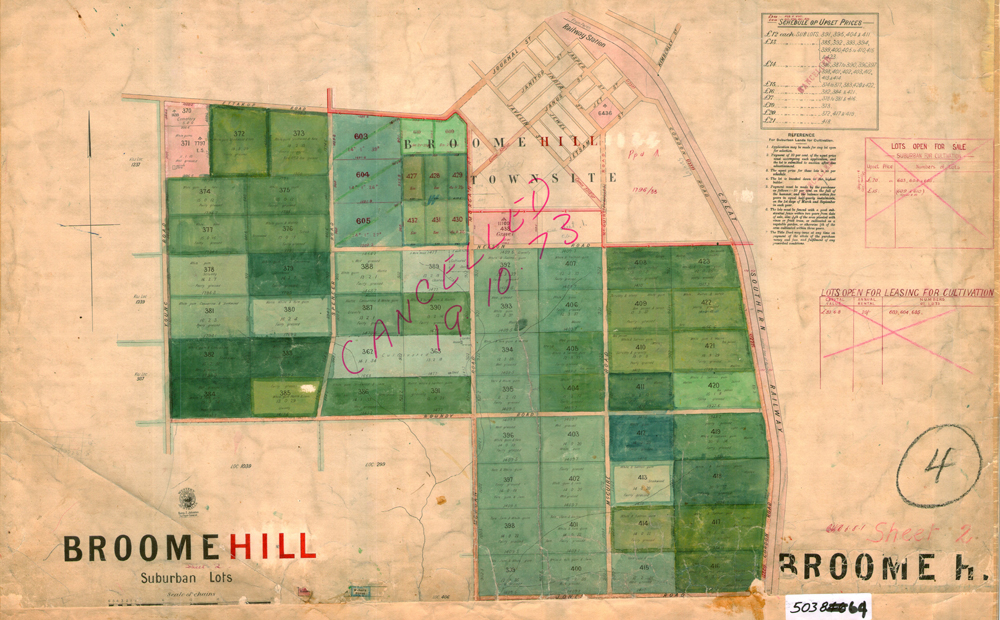
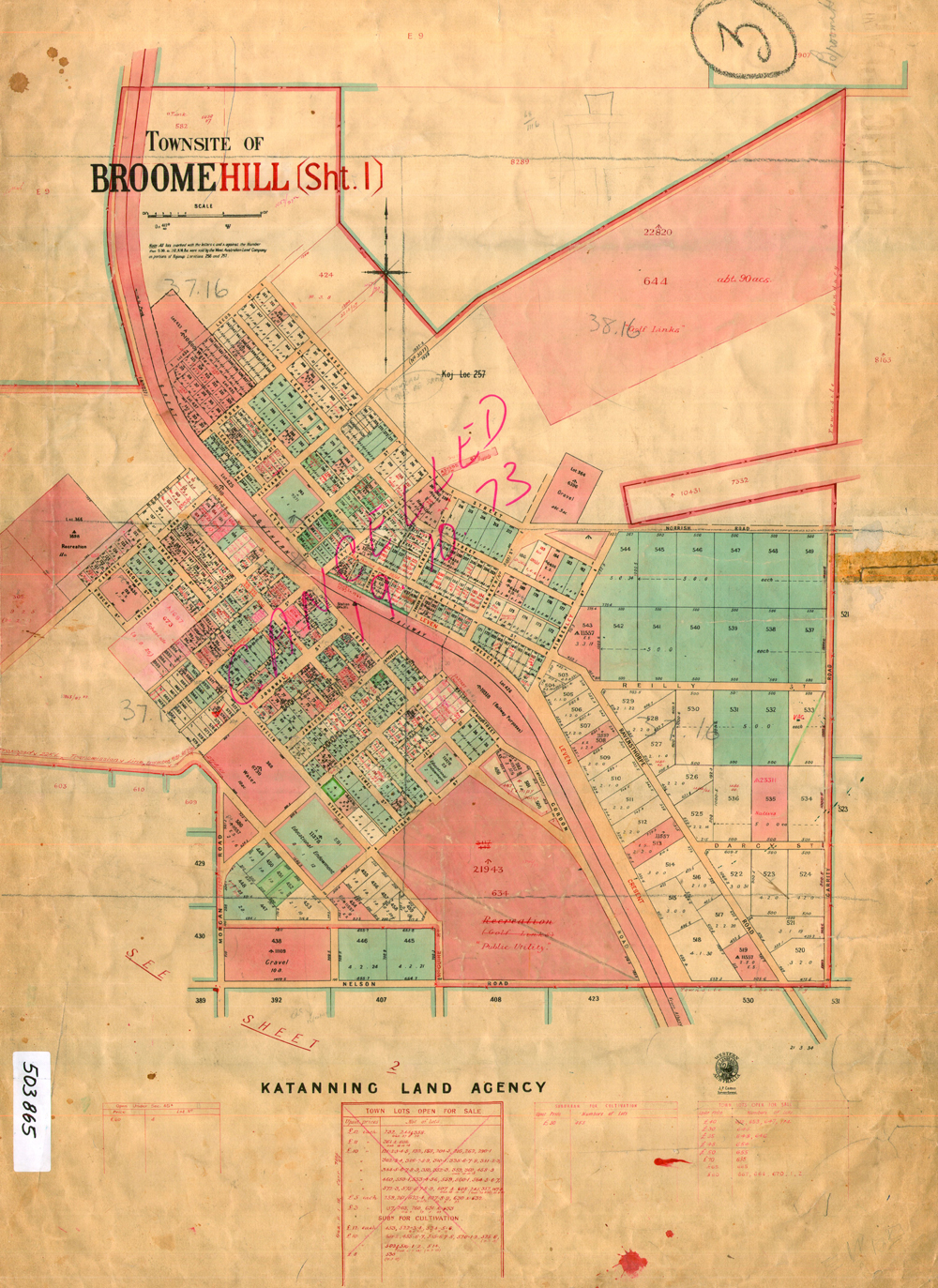
BROOMEHILL MAPS The original townsite maps of both Broomehill and Katanning in approx 1892 were very similar in building lots. Broomehill was to be the main town. However the difference in development came when Mr Piesse a Parliamentarian of note had the Flour Mill built in Katanning which meant all roads and produce were channelled in that direction hence the rapid growth in that area. Broomehill was well known for bark stripping which early photos in the railway siding clearly illustrate.
|
|
|
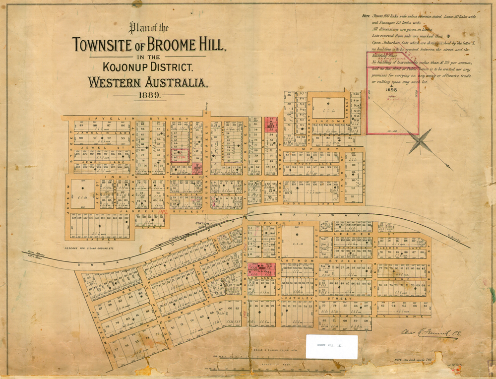
MAP OF TOWNSITE OF BROOME HILL 1889 |
|
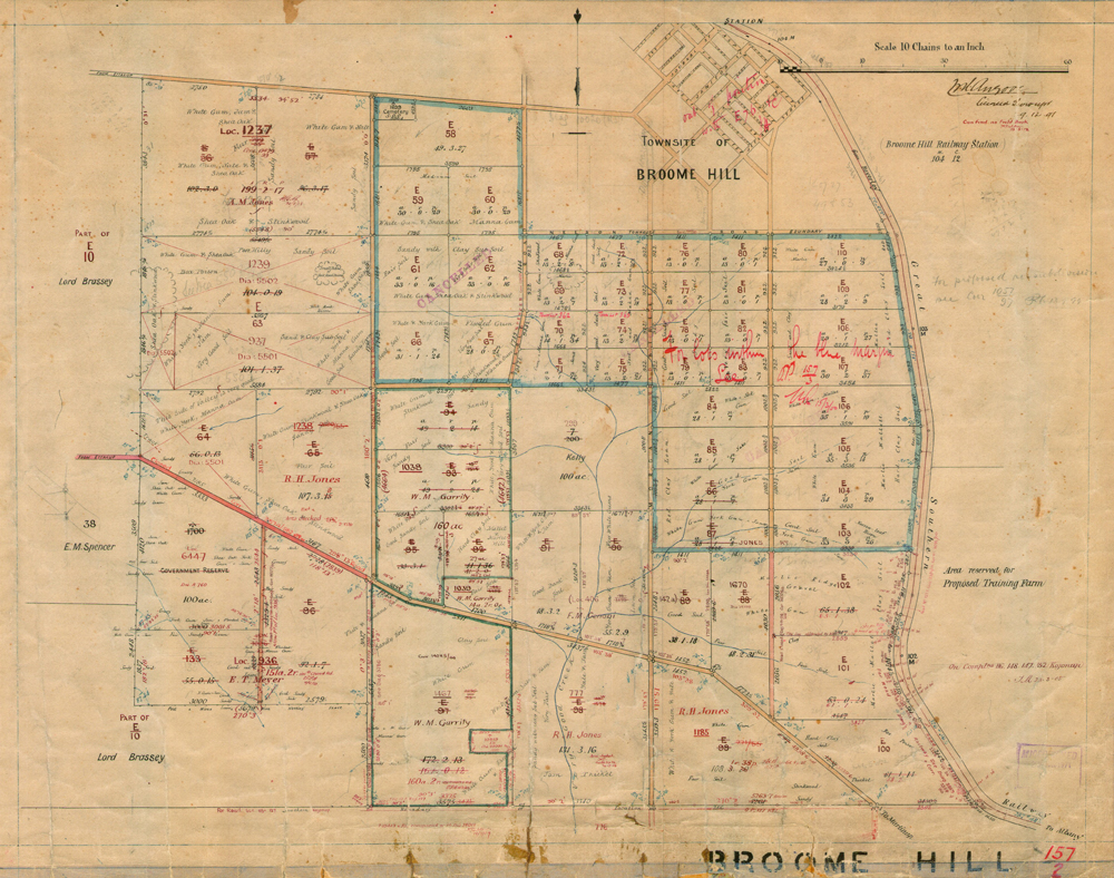
MAP OF BROOME HILL 1891 |
|
MAP OF TOWNSITE OF BROOME HILL 1897 |
|
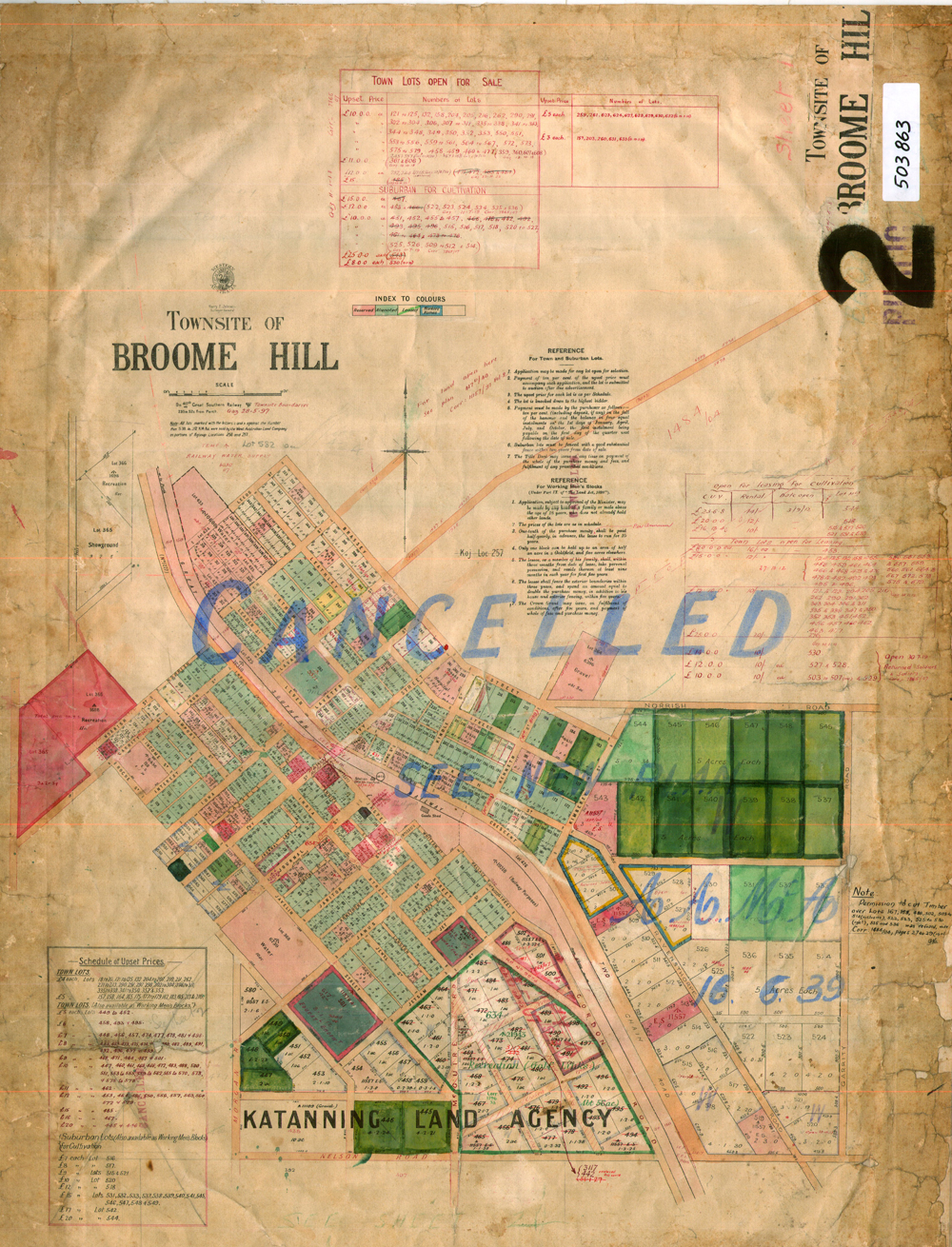
MAP OF TOWNSITE OF BROOME HILL 1898 |
|
MAP OF TOWNSITE OF BROOME HILL 1899 |
|
MAP OF BROOMEHILL 1918 |
|
MAP OF TOWNSITE OF BROOMEHILL 1918 |
|
Every endeavour has been made to accurately record the details however if you would like to provide additional images and/or newer information we are pleased to update the details on this site. Please use CONTACT at the top of this page to email us. We appreciate your involvement in recording the history of our area.
|
|
References: Article: Internet Image: State Library of Western Australia
Copyright : Gordon Freegard 2024 |